Rock River Region

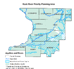
The Water Survey is conducting a scientific investigation into the water supply of the Rock River region, which includes Jo Daviess, Stephenson, Winnebago, Boone, Carroll, Ogle, Whiteside, Lee, Rock Island, Henry, and Bureau counties. Most of the region can use groundwater resources from two major aquifer systems: (1) sands and gravels, primarily in the Green River Lowlands; and (2) the Cambrian-Ordovician sandstone aquifer system, which ranges widely in depth in the region. Some smaller water supplies in this region also draw from shallower Silurian-Devonian or Galena Platteville bedrock.
Irrigation in the Region
The Green River Lowlands has extensive irrigation due to sandy soils in much of the region. Most of the irrigation wells, however, are not in the shallow Tampico Aquifer but in the deeper Sankoty Aquifer, which is separated from the Tampico by an extensive clay layer.
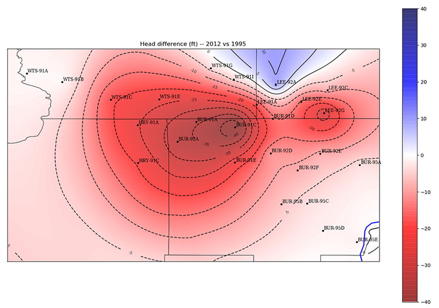
Following the 2012 drought, irrigation increased substantially in the Green River Lowlands, resulting in pronounced seasonal drawdown in the Sankoty aquifer, over 40 feet greater than the last study in this region in 1995. In some areas, especially the northwest corridor of Bureau County, the aquifer is locally confined, and the risk of partially dewatering the aquifer is much higher. Limited observational and anecdotal data suggest that summertime dewatering may already be occurring, even under non-drought conditions. In the short term, this can result in the need to deepen some wells and points to a larger need to continue collecting data and modeling this area. To this end, the ISWS has expanded its real-time groundwater monitoring capabilities in the region. Additionally, models are in development to explore the consequences of continued irrigation growth and/or a return to drought conditions.

Change in water levels from 1995 to 2012 measured during the peak of summer irrigation pumping. Red indicates a decline. Irrigation has a considerable impact on water levels in this region.
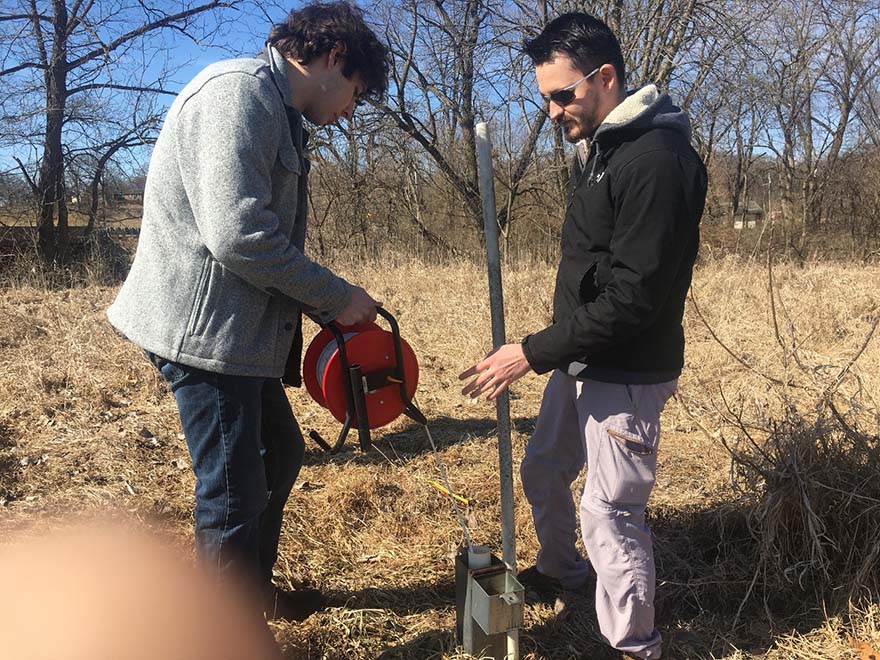
University of Illinois graduate student Anthony Groenewald and Water Resources Application Developer Vlad Iordache measure a water level at one of the monitoring wells in the Green River Lowlands.
Rockford
The city of Rockford and surrounding areas employ two major groundwater resources to meet their demands: (1) the shallow, alluvial aquifer of the Rock River valley, and (2) the deeper Cambrian-Ordovician sandstone aquifer system. These two aquifers are productive and should not pose a limit to the area’s ability to meet projected demands. However, there are also water contamination issues in both aquifer systems, especially the shallow alluvial aquifer. Changes in pumping in the shallow aquifer system should be mindful of potential contamination as these changes may induce contaminant migration. The Cambrian-Ordovician system is most productive within the Rock River valley where it is directly overlain by the shallow aquifer, but this is also where it is most vulnerable to contamination by pollutants in the shallow aquifer. Steps should be taken to ensure the integrity of existing wells and proper abandonment of out-of-service wells to prevent contamination through these pathways.

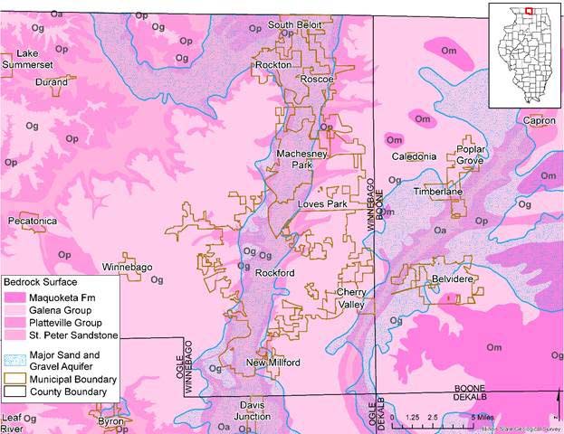
Bedrock surface and the major sand and gravel alluvial aquifers in the Rockford area.
Unlike most of the rest of the state, the Cambrian-Ordovician sandstone aquifer system is close to or at bedrock surface in Winnebago, Boone, and DeKalb counties. As a result, the primary concern is not supply as much as contamination, particularly the downward leakage from already contaminated unconsolidated material. The Water Survey is investigating how long-term declines in the sandstone aquifer of Rockford influence this downward leakage and whether this poses a threat to the current water supply.
Surface Water System
While there are only a few facilities relying on surface water in the region, they account for the majority of the water demand in the region. Two nuclear power plants, Exelon-Quad Cities and Exelon-Byron, withdraw water from the Mississippi River and the Rock River, respectively, for cooling purposes. Both rivers have ample flow to meet current demands. The major tributaries in the region, including the Pecatonica, Kishwaukee, and Green rivers, are also available to meet potential future demands.
Interactive Maps
Interactive maps specific to this region will become available as the water supply planning process progresses. View statewide maps with information related to groundwater demands.
Rock River Region Publications
- Water Demand in the Rock River Water Supply Planning Region, 2010-2060
- Changing Groundwater Levels in the Sandstone Aquifers of Northern Illinois and Southern Wisconsin: Impacts on Available Water Supply
- Karst of the Driftless Area of Jo Daviess County, Illinois
- Rock River basin streamflow assessment model
- Groundwater Conditions of the Principal Aquifers of Lee, Whiteside, Bureau, and Henry Counties, Illinois
- Ground-water contamination by volatile organic compounds: site characterization, spatial and temporal variability
