Middle Illinois Region

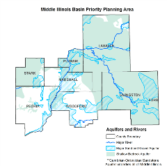
The Water Survey, with assistance from colleagues at the Illinois State Geological Survey, finished its initial assessment of water supply in the Middle Illinois region in 2018. Significant water resources, including both groundwater and surface water, are available to meet demands in the Middle Illinois region. Most of the region (encompassing LaSalle, Livingston, Marshall, Peoria, Putnam, Stark, and Woodford counties) can use groundwater resources from two major aquifer systems: (1) sands and gravels, primarily in the Illinois River Valley; and (2) the deeper Cambrian-Ordovician sandstone aquifer system, although its usefulness decreases farther south because of increasing depth and salinity.
Sand and Gravel Analysis
While sand and gravel aquifers should be sufficient on a regional level to meet projected demands, local issues may limit use of these aquifers, and there are almost 30 public water supply systems that could be considered at risk.
This map contains information regarding demands and available water supply in the shallow aquifers of the Middle Illinois region. The results in this map are provisional and under review by the Middle Illinois water supply planning committee. For more information, contact Daniel Abrams at 217-244-1520 or dbabrams@illinois.edu.
Last updated April 3, 2018
Sandstone Analysis
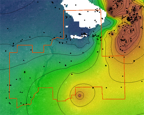
The sandstone aquifers are projected to have enough water to satisfy demands to 2060, except possibly in east-central LaSalle County along the Illinois River where the sandstone is not in hydrologic communication with the Illinois River. As a result, relatively limited withdrawals can have a comparatively large drawdown.
This map contains information regarding demands and available water supply in the Cambrian-Ordovician sandstone aquifers of the Middle Illinois region. The results in this map are provisional and under review by the Middle Illinois water supply planning committee. For more information, contact Daniel Abrams at 217-244-1520 or dbabrams@illinois.edu.
Last updated April 3, 2018
Surface Water Analysis
The Illinois River generally provides a sufficient and reliable water supply for industries and the city of Peoria, the only public water supply withdrawing from it. However, water withdrawal for thermoelectric power generation could be restricted because of low flows set by permits and elevated water temperatures during drought conditions. The Vermilion River augmented by off-channel storage provides an adequate water supply for Pontiac and Streator, although their withdrawals may potentially cause adverse impacts on aquatic ecosystems in the river.
Low flow in the Illinois River has decreased significantly in recent decades due to declining water diversions from Lake Michigan by Chicago, and this decrease is expected to continue. During low flow conditions, the Illinois River between Marseilles and Kingston Mines appears to be losing water even though the drainage area increases dramatically downriver. Understanding these changes in low flow is critical for protected flow management, thus it is important to accurately monitor low flow in the river.
Middle Illinois Publications
- Water Supply Planning: Middle Illinois Assessment of Water Resources for Water Supply Final Report
- Water Demand in the Middle Illinois Water Supply Planning Region, 2010-2060
- Peoria-Pekin Regional Ground-Water Quality Assessment

