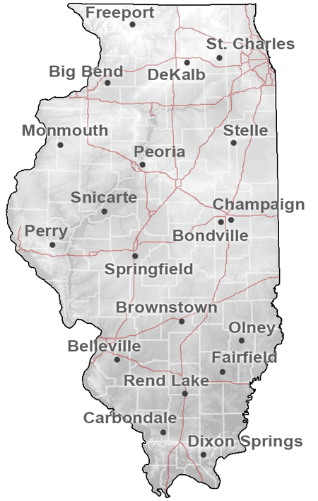
ICN: Stations Map and Information
 At right is a map of the nineteen stations that currently make up the Illinois Climate Network (ICN). For more information concerning a specific station, please see the metadata.
Data can downloaded by following the link at the bottom of this page.
To view a larger map image, click on the icon at right.
Current ICN stations. |
|||||
| Name | 3-Letter ID | Latitude | Longitude | Altitude | Start date |
| (° N) | (° W) | (m) | of record | ||
| Belleville | FRM | 38.5184 | 89.8415 | 133 | 11/16/1989 |
| Big Bend | BBC | 41.6341 | 90.0394 | 182 | 6/11/2004 |
| Bondville | BVL | 40.0529 | 88.3715 | 213 | 8/20/1990 |
| Brownstown | BRW | 38.9492 | 88.9598 | 177 | 8/25/1989 |
| Carbondale | SIU | 37.6998 | 89.2435 | 137 | 12/14/1989 |
| Champaign | CMI | 40.0840 | 88.2404 | 219 | 2/16/1989 |
| DeKalb | DEK | 41.8417 | 88.8507 | 265 | 1/1/1989 |
| Dixon Springs | DXS | 37.4368 | 88.6674 | 165 | 2/9/1990 |
| Fairfield | FAI | 38.3818 | 88.3897 | 136 | 9/14/1991 |
| Freeport | FRE | 42.2801 | 89.6734 | 265 | 7/1/1989 |
| Kilbourne | SFM | 40.1583 | 90.0872 | 152 | 1/1/1989 |
| Monmouth | MON | 40.9334 | 90.7236 | 229 | 7/21/1989 |
| Olney | OLN | 38.7377 | 88.1031 | 134 | 8/24/1989 |
| Peoria | ICC | 40.7087 | 89.5112 | 207 | 1/1/1989 |
| Perry | ORR | 39.8058 | 90.8238 | 206 | 7/1/1989 |
| Rend Lake | RND | 38.1356 | 88.9232 | 130 | 3/18/1990 |
| St.Charles | STC | 41.9046 | 88.3610 | 226 | 1/1/1988 |
| Springfield | LLC | 39.7273 | 89.6106 | 177 | 1/1/1989 |
| Stelle | STE | 40.9496 | 88.1588 | 211 | 1/1/1989 |
