Deep Sandstone Network
The Illinois State Water Survey, in partnership with the Illinois Department of Natural Resources through the Office of Water Resources, has established a long-term groundwater monitoring well network of deep sandstone wells in northeastern Illinois.
The wells are open to the Cambrian-Ordovician sandstone aquifer system, which consists of the St. Peter, Ironton-Galesville, and Mt. Simon sandstone units. The monitoring wells are a mix of dedicated observation wells, abandoned municipal production wells, and production wells that are active only on an emergency basis. The purpose of this network is to monitor the deep sandstone aquifers around the Chicago metropolitan area in response to inner and northern suburban communities switching to Lake Michigan water and in response to continued withdraws by western and southwestern suburban communities, which will aid in long-term water supply planning in the region. The following wells are equipped with real-time data. Click on a well to view the hydrograph and download the data.
Real-Time Monitoring Wells
- Des Plaines 7
- Elwood 7
- Fermilab 4
- Fox Metro 2
- Geneva 5
- Hickory Hills 2
- Joliet 23
- Joliet 27
- Joliet 29
- Joliet Corrections 3
- Lake Barrington Shores 2
- Metropolitan Sanitary District (Calumet Plant)
- Newark 1 (Ironton-Galesville)
- Newark 2 (St. Peter)
- Orland Park 11
- Villa Park 7
- Zion 1 (St. Peter)
- Zion 3 (Upper Mt. Simon)
- Zion 4 (Lower Mt. Simon)

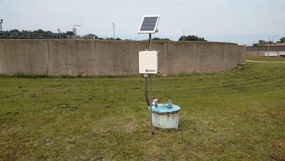
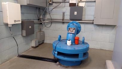
Monitoring wells throughout Illinois send water level data back to the Water Survey researchers in Champaign-Urbana. These can be both installed on wells outside (above) and inside well houses (below).
