City of Decatur Groundwater Monitoring Network
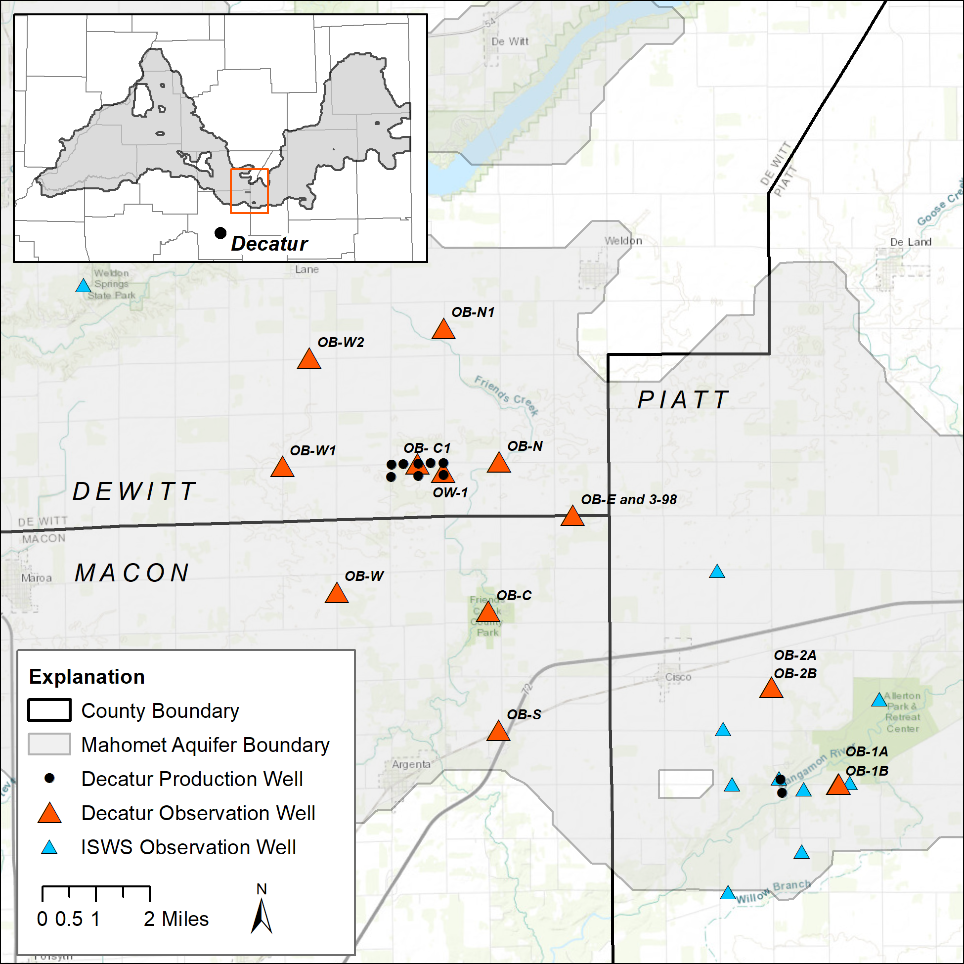
The City of Decatur maintains a groundwater monitoring well network in southeastern DeWitt, northeastern Macon, and western Piatt counties to monitor groundwater levels in the Mahomet aquifer and overlying Glasford aquifer. This monitoring well network was established in 1989 during construction of Decatur's emergency supply well field. The purpose of the network is to monitor water levels when the City of Decatur uses the well field under emergency use, but also serves as a valuable record of seasonal and long-term changes in the Mahomet aquifer. Since 2020, the City of Decatur has partnered with the Illinois State Water Survey to measure water levels in near real-time on an hourly basis at select monitoring wells. Tracking water levels long-term provides valuable information on aquifer conditions and whether current demands on the aquifer are outpacing recharge to the system. This information will be important as the aquifer becomes relied upon more for domestic, municipal, and irrigation use.
The following wells are equipped with real-time data or are measured periodically. Click on a well to view the hydrograph and download the data. All wells are open to the Mahomet aquifer unless noted.
Real-Time Monitoring Wells
Periodic Monitoring Wells
In addition, these hydrographs can be accessed through the ISWS interactive map of observation wells.
Relevant ISWS Publications
- Reconnaissance Study of Ground-Water Levels and Withdrawals in the Vicinity of DeWitt and Piatt Counties
- Long-Term Ground-Water Level Monitoring Network and Aquifer Hydraulic Properties Database for DeWitt, Piatt, and Northern Macon Counties
- The Impact of Emergency Pumpage at the Decatur Well Fields on the Mahomet Aquifer: Model Review and Recommendations
- The 2012 Drought in Illinois