Solid Terrain Model of Illinois
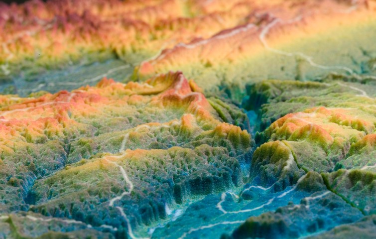
The winner of Best Poster at the 2003 Illinois GIS Association fall conference and the Beckman Institute for Advanced Science and Technology at the University of Illinois Image of the Week was Illinois Topography in 3D. Instead of a GIS map printed on paper, it consisted of a color plaster model of Illinois terrain held to an exhibit board by Velcro. This terrain model output is the next step beyond onscreen spinning 3D models, and is reminiscent of the papier-mâché models many of us saw in museums as children. This new generation of map models; however, are produced at dramatic savings in time and cost, and can be much more accurate because they are generated directly from Digital Elevation Models. The truly exciting thing about using this medium is that it makes the terrain come alive. This map seemed to be telling the story of the glaciers which advanced and retreated repeatedly across Illinois, scraping and smearing the landforms they covered. The terrain heights were scaled to appear thirty times higher than they really are. The map was created in collaboration with the Imaging Technology Group at the Beckman Institute for Advanced Science and Technology at the University of Illinois using the newly installed ZCorp Z406 printer. There were three major steps involved in creating the model; build the computer model, print it, and clean and treat it. First, build the computer model, set the extent and vertical exaggeration, and export to VRML format. A limitation in the exported VRML file required additional processing of the image files used to color the model. Second, the computer file is sent to the printer. The Z406 printer builds the model from the bottom up in layers of plaster powder on an 8in x 10in platform that retracts into the printer as the model gets taller. It squirts a colored adhesive in each layer of powder until the full height of the model is printed. Finally, at the completion of printing the model is surrounded by loose plaster powder. The excess powder is removed by vacuum then finely cleaned with an airbrush. The model is then immersed in wax to add strength and bring out the vibrancy of the colors. (More info) Photography courtesy of Benjamin Grosser, Beckman Institute for Advanced Science and Technology at the University of Illinois Illinois Solid Terrain Model statistics at a glance: |
|