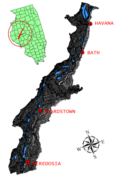
Shaded Relief Model of the Illinois River Floodplain
The Shaded Relief Model of the Illinois River Floodplain between Meredosia and Havana Illinois was created as part of a multi-disciplinary project between researchersat the Illinois State Water Survey and the University of Illinois. This segment of the river is roughly 50 miles in length. The original documents were created by the U.S. Army Corps of Engineers in 1902 by J. W. Woermann. The contour interval of the source material is one foot, and the cell size of the DEM from which the shaded relief was derived is 30 feet. A portion of the funding was provided by a grant from the National Science Foundation (NSF). Development of metadata was partially funded through a cooperative agreement with the Federal Geographic Data Committee (FGDC). The purpose of this image is to provide a 3-dimensional view of the Illinois River in 1904. Data set credit: Kingsley Allan, Kathy Brown, and Jack Lukehart, Illinois State Water Survey. Partially supported by EPA/NSF Water and Watershed Program grant DEB-9613562, John B. Braden, Principal Investigator. Composed by Dao Trinh, November 1999 |
|
