Pontiac (Illinois-American)
System Information
System Description
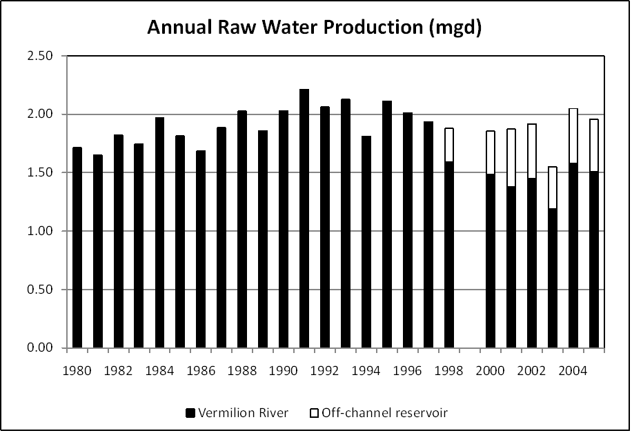
Water is pumped from the Vermilion River at up to 3,125 gpm either directly to the treatment plant or via an off-channel reservoir. That reservoir also serves as a storage basin for low nitrate water and as a pre-treatment sedimentation basin.Satellite Communities and Water Districts
None
Population Served: |
12000 |
County: |
Livingston |
Watersheds: |
Vermilion - Illinois |
Water Source
| Name | Type | Stream | DA (sq mi) | SA (ac) | Capacity | Year Est. | Est. 2010 Cap. (ac-ft) |
| Vermilion River* | RW | Vermilion R | 579 | 38 | 153 | ||
| Off-channel reservoir | OCR | Vermilion R | 0 | 250 | 2026 | 1992 | 2026 |
1989 Study: |
20-year drought yield insufficient at present level of water use. |
USGS Gages: |
Vermilion River at Pontiac (05554500) |
