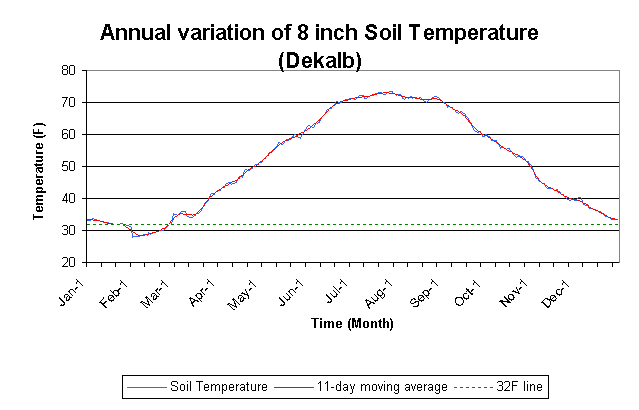
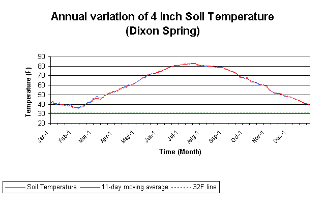
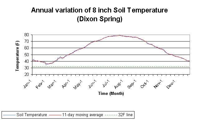
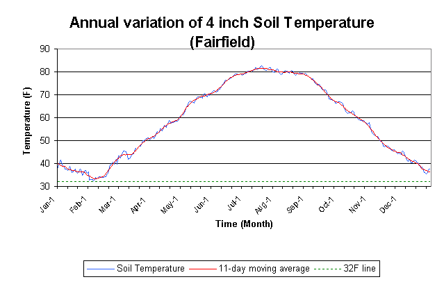
Soil temperatures are important for a variety of agricultural and horticultural activities. Long-term averages have been calculated from a network of sites established in the 1990s by the Illinois State Water Survey, called the Water and Atmospheric Resource Monitoring (WARM) program.
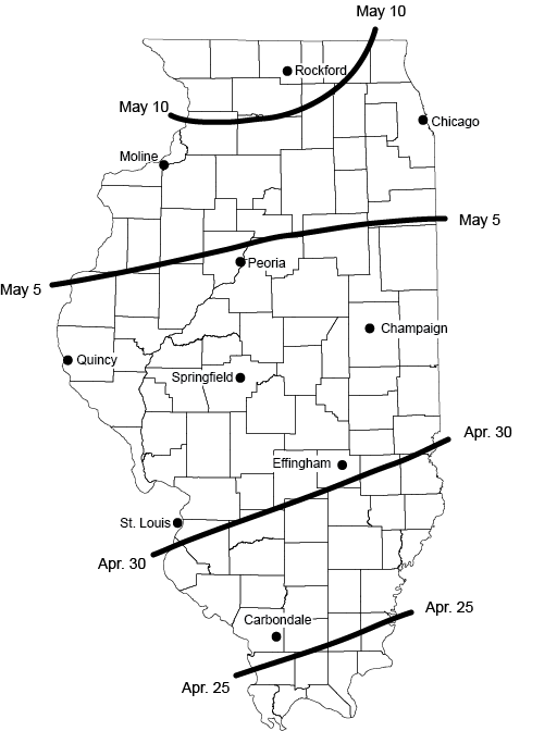
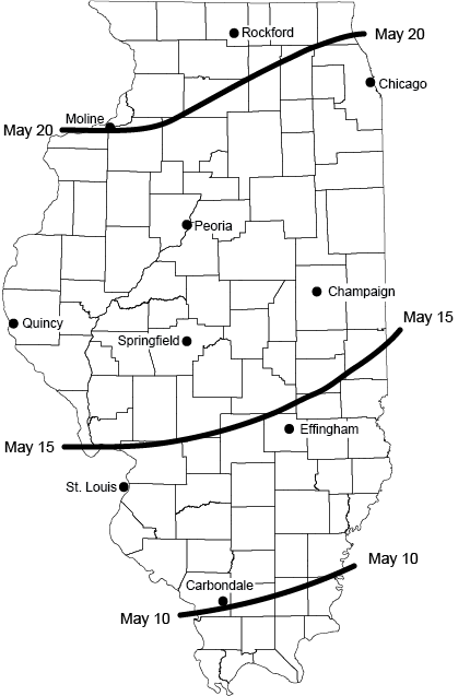
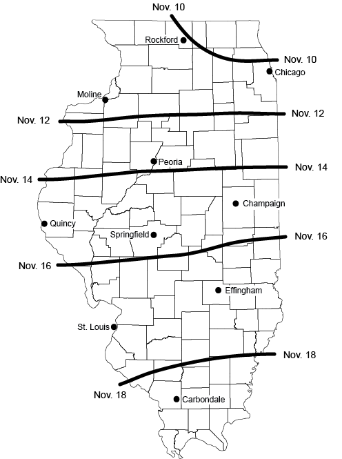
Below are the average dates when the 4-inch soil temperature reaches 50 and 60 degrees in spring and when it reached 60 and 50 degrees in fall.
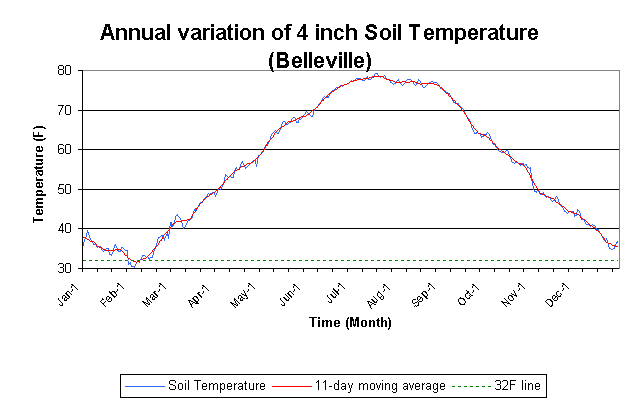
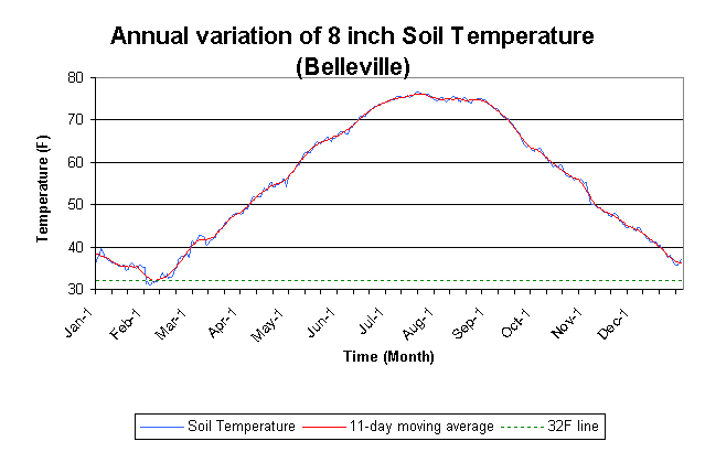
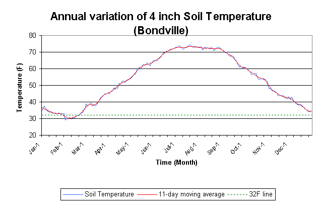
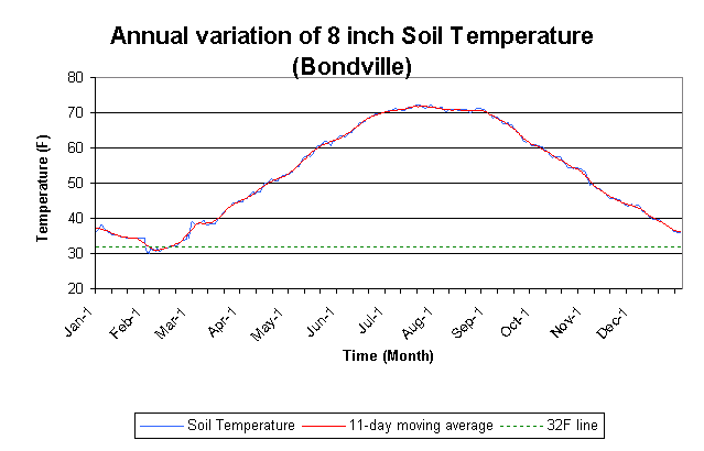
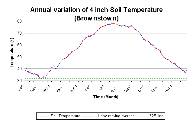
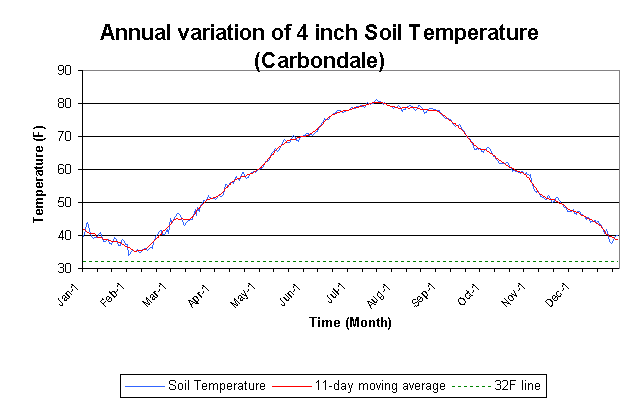
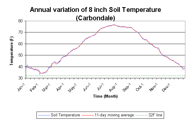
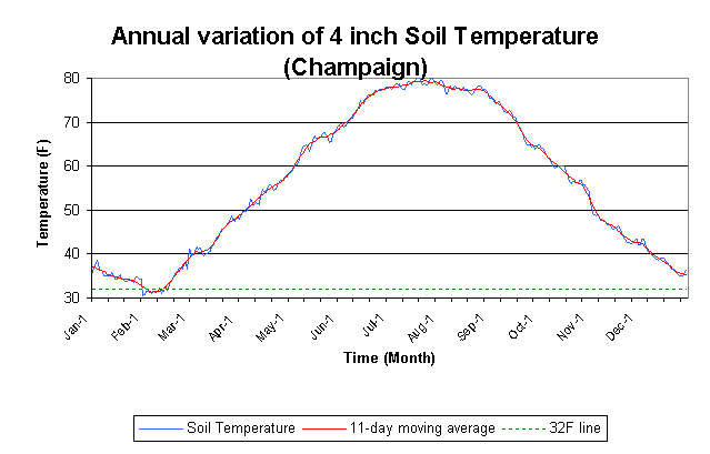
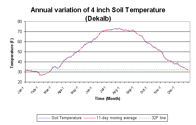
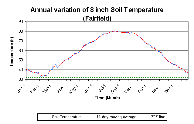
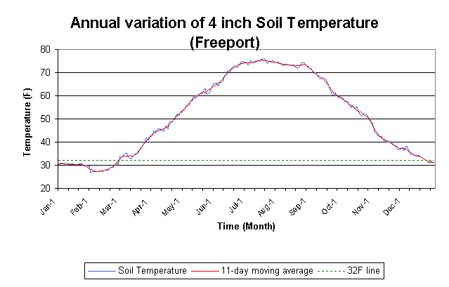
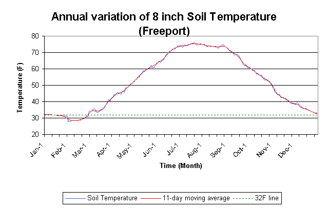
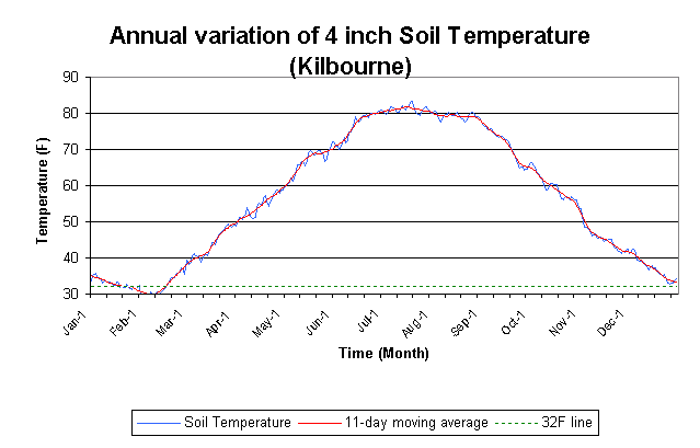
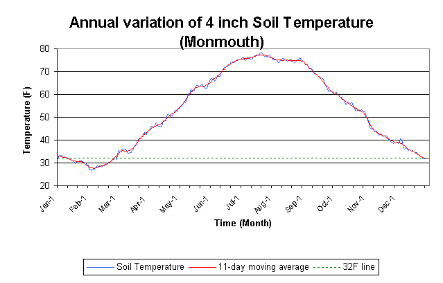
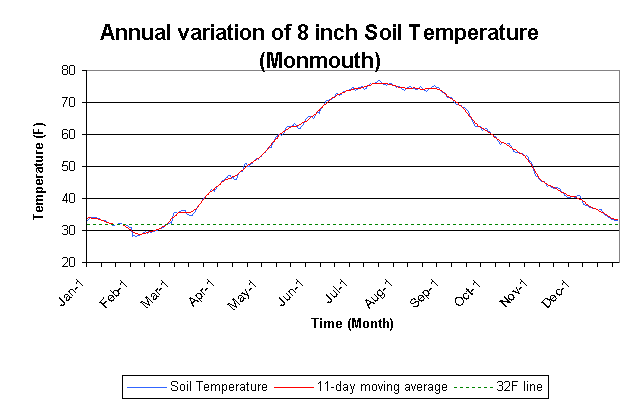
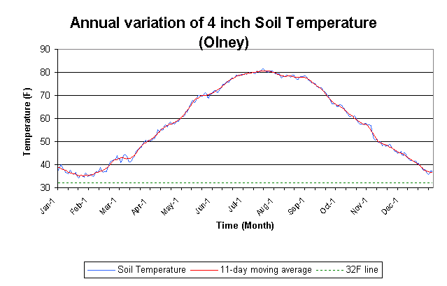
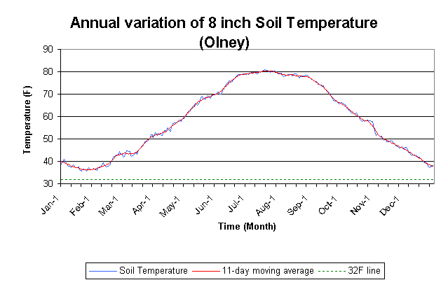
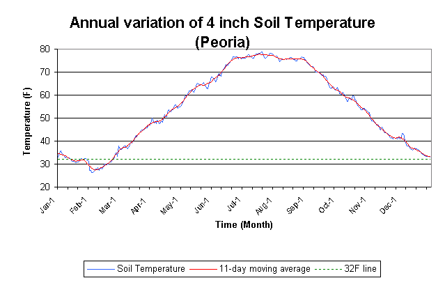
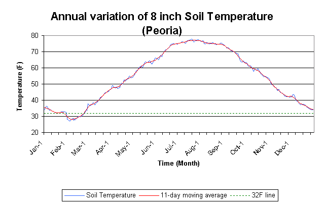
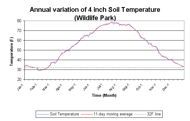
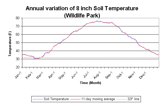
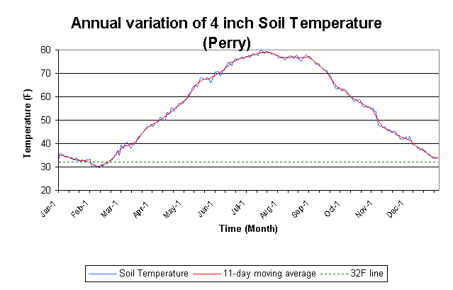
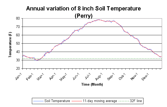
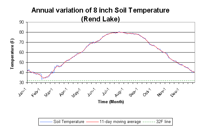
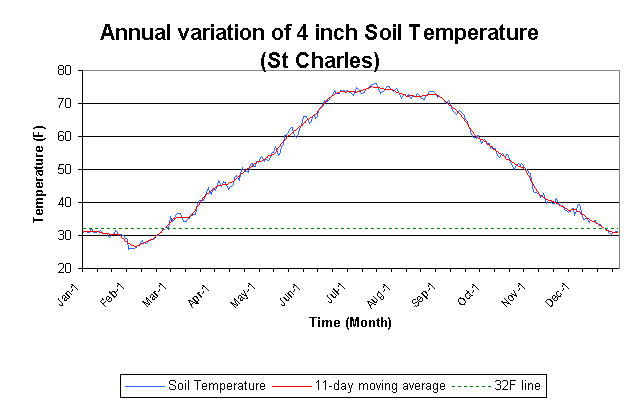
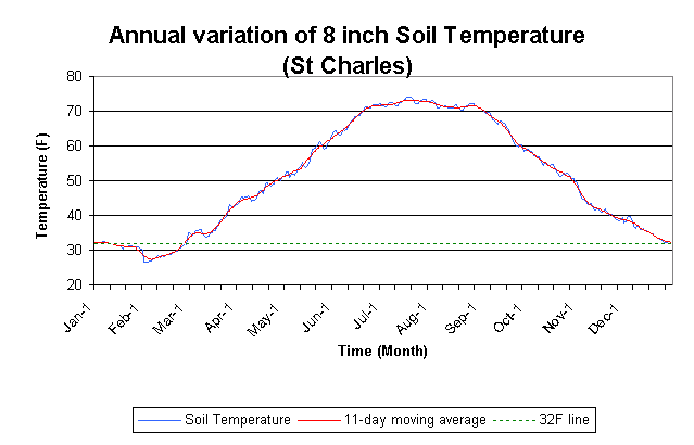
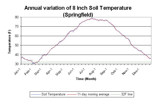
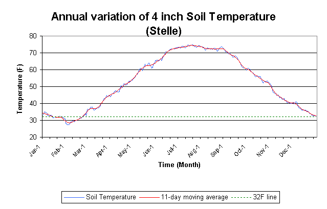
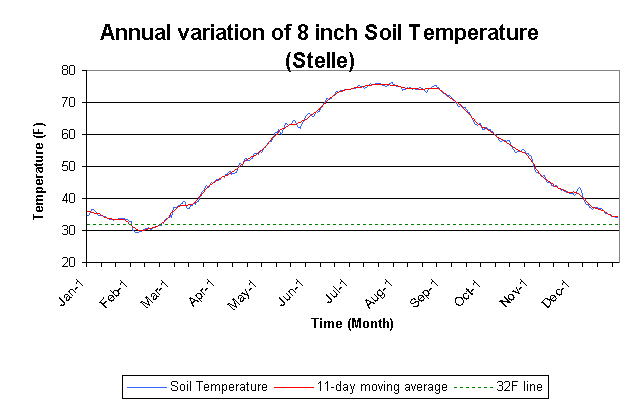
These are daily averages calculated from all available data at each station for soil temperatures at 4 and 8 inches. The measurements are made under grass. Soil temperatures under other ground covers or under bare ground will vary somewhat from those shown here.
More information on soil temperatures, including current conditions can be found on the WARM site.
| 4-Inch Depth | 8-Inch Depth | |
|---|---|---|
| Belleville | Plot | Plot |
| Bondville | Plot | Plot |
| Brownstown | Plot | Plot |
| Carbondale | Plot | Plot |
| Champaign | Plot | Plot |
| De Kalb | Plot | Plot |
| Dixon Springs | Plot | Plot |
| Fairfield | Plot | Plot |
| Freeport | Plot | Plot |
| Kilbourne | Plot | Plot |
| Monmouth | Plot | Plot |
| Olney | Plot | Plot |
| Peoria | Plot | Plot |
| Peoria Wildlife Park | Plot | Plot |
| Perry | Plot | Plot |
| Rend Lake | Plot | Plot |
| St. Charles | Plot | Plot |
| Springfield | Plot | Plot |
| Stelle | Plot | Plot |