Institute of Natural Resource Sustainability
University of Illinois at Urbana-Champaign
Illinois State Climatologist Office
Jim Angel, state climatologist
November 30 - December 1, 2006, Winter Storm in Illinois
Jim Angel, state climatologistThe first major winter storm of the season struck Illinois on November 30-December 1. Snowfall amounts reported were 12 inches or more at 14 sites in central and northern Illinois, including 18.0 inches at Princeton. Fifty other sites in the region reported between 6 and 12 inches. The heaviest snowfall was along and west of the Illinois River. Many locations also had significant sleet and freezing rain, especially to the east of the Illinois River. The accumulated ice load and high winds caused numerous power outages, leaving some 500,000 households and businesses without power across the St. Louis area and into central Illinois, according to the National Weather Service.
This page contains links from individual National Weather Service (NWS) offices, the Midwestern Regional Climate Center, and other locations.
Figure 1. NOAA GOES satellite image of the snow band.
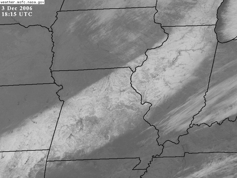
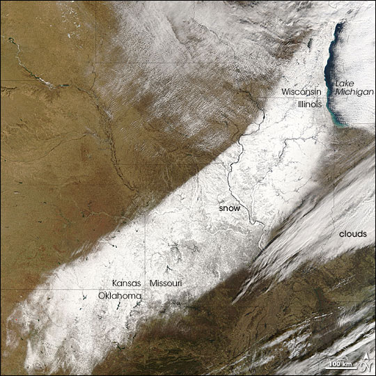
Figure 2. NASA MODIS satellite image of the snow band. Link to NASA story.
Reports from National Weather Service Offices and the Midwestern Regional Climate Center:
Northwest Illinois (Davenport NWS office)
Northeast Illinois (Chicago NWS office)Central Illinois (Lincoln NWS office)
- Illinois State Water Survey
- All files and information �2008
- Last Modified: March 6, 2008